Products
Using the best practices, the team in ISATECH is able to provide products of the highest level for your company.
General Products
ISATECH CORPORATION is a geospatial information company with extensive experience in the cartography generation, spatial data modeling, risk analysis, property management, cadastre, generation of digital elevation models and precision agriculture. Additionally, we produce software for the business architecture development, Geographic Information Systems applications, as well as the generation of production models to capture and manage information in real-time. The company is committed to developing applications and geographic tools that allow the improvement of production, detection, investigation and collection processes, always guaranteeing the highest quality, constant monitoring and support.
Comprehensive Analytical Cadastral System
Strong and integral technological solution, made for the Colombian territory, that allows and provides support in cadastral management and operation with a multipurpose approach. It allows intelligent data capture, management …
View detail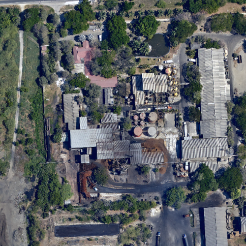
Orthophotos
Aerial photography, in which the displacements caused by the inclination of the camera or sensor and the curvature of the terrain have been corrected.
View detail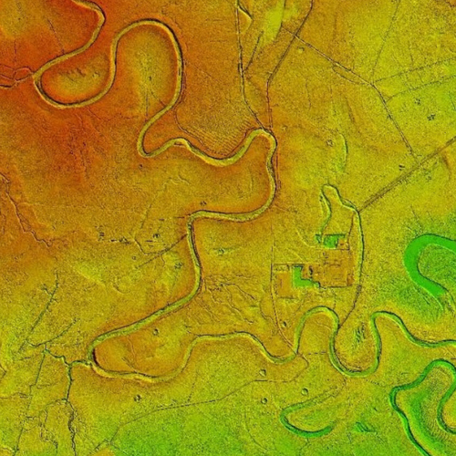
DSM-DTM
Visual representation of the height values that allow the characterization of the forms of the relief and the elements or objects present on the earth's surface.
View detail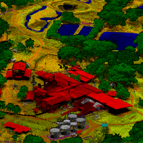
Classified LiDAR Information
Points from the LiDAR data cloud classified according to the type of object that was reflected by the laser pulse.
View detail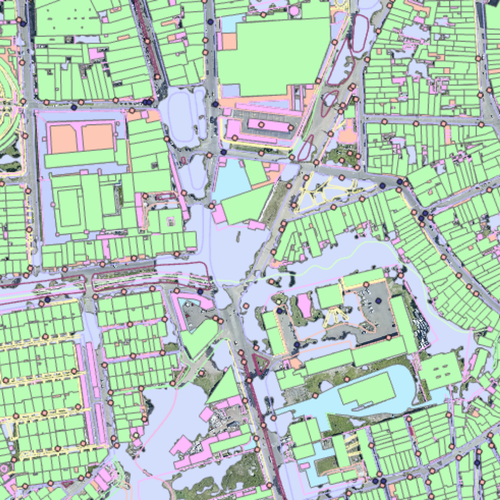
Cartography
Two-dimensional vector representation through lines, points and polygons of the elements present on the earth's surface.
View detail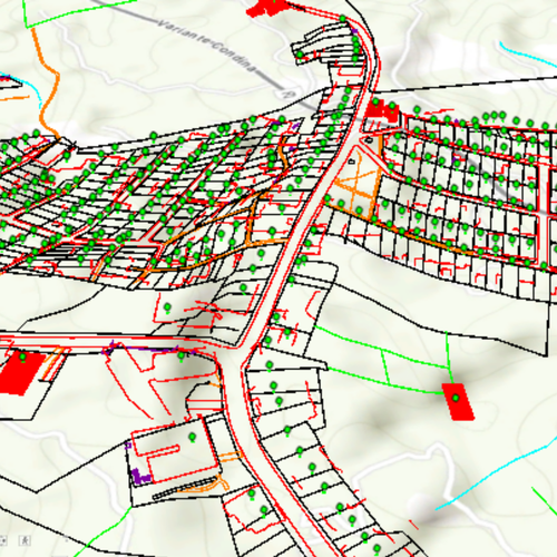
3D restitution
Three-dimensional vector representation of the elements on the earth's surface that records the real height values of these elements.
View detail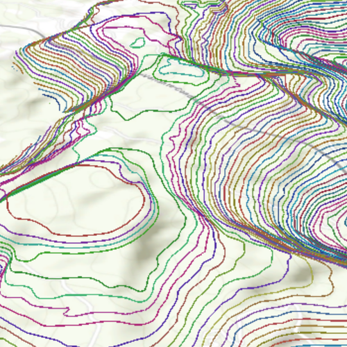
Contour lines
Isolines that join all the points on a map that are at the same altitude.
View detail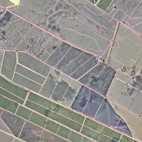
Geospace Databases
Databases that allow the storage and consultation of the data that represents the vector objects present on the earth's surface.
View detail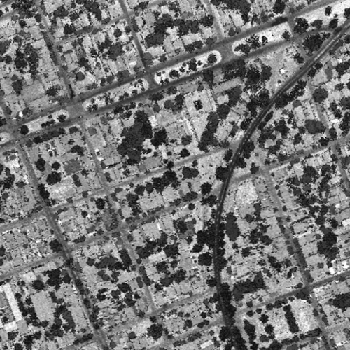
Intensity imaging
Rasterized visual representation (raster format) with intensity values of a set of points from the LiDAR data.
View detail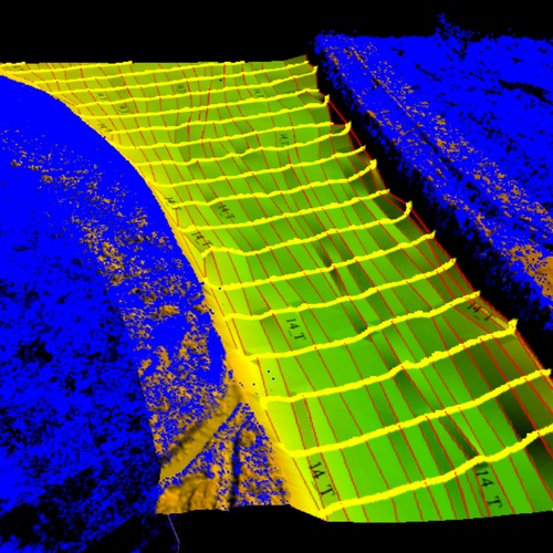
Continuous DTM
A Digital Terrain Model that integrates bathymetric information of the water bodies in the area of interest.
View detail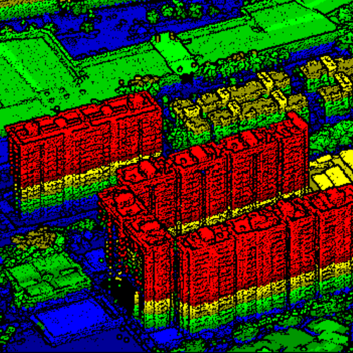
3D Simulation
3D modeling and LIDAR data processing to obtain topography and digital surface models for the purpose of cities and structures modeling.
View detailImplementation and development of Software
Robust comprehensive solutions made to measure and in the cloud with offline capabilities for comprehensive decision-making within your organization.
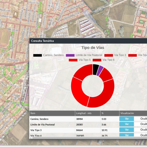
SICAM WEB
This is a geospatial computing solution oriented towards a web environment for management within a municipality.
View detail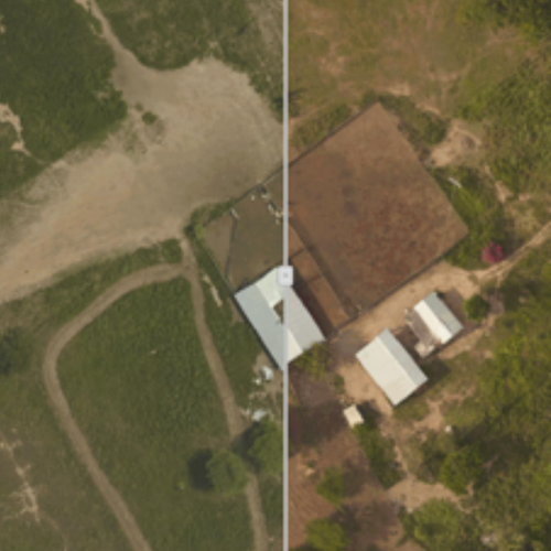
Multi-temporal analysis management system
It is a geospatial computer solution oriented towards a web environment that seeks the determination of abrupt changes on the ground as a consequence of anthropic and natural phenomena through …
View detail
Business Architecture Structuring
Modeling of aspects at Business, Information Systems and Technology level within an organization.
View detail
Document management system
A computer solution designed for analysis and document management, oriented towards spatial issues such as the land management of a project.
View detail